GeaCron app icon
Official build · Clean

GeaCron APK Download for Android

GEACRON
educationHistorical atlasWorld historyInteractive maps
8.0101 reviews
933Downloads
4.34 MBSize
Why download GeaCron APK from APKBA?

APKBA gives you the package name, version details, SHA-256 checksum, VirusTotal scan notes, install-test result, Android requirement, and screenshot evidence before the download. Review these signals to download GeaCron APK with more confidence.

About GeaCron APK

GeaCron is an educational historical atlas for Android that helps students, teachers, and curious readers connect places with the years that shaped them. Choose a year, move backward or forward through time, and explore a world map with plain or relief styling. Search tools lead to areas, cities, and events, while optional layers reveal borders, locations, and historical movements. A year-sequence view and multilingual controls make comparisons easier to revisit. It is a compact way to study changing geography and historical context without replacing the detail of a full reference book.

PublisherGEACRON
Packagecom.geacron
SourceAPKBA Verified Mirror
Categoryeducation

Features & use cases

Browse Historical Borders by Year

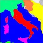
GeaCron turns a selected year into a map-based history lesson. Enter a year or use the backward and forward controls to move across centuries, with the atlas reaching back to 3000 BC. The map can be zoomed for a closer regional view, and the plain or relief presentation helps separate geographic shape from political detail.

This workflow is useful when a date, border, or place needs context instead of a single isolated fact. The date controls keep the time frame visible while you move, so you can follow how a region changes and return to a meaningful point. It suits classroom preparation, self-guided reading, and quick comparisons while researching a historical question.

Search Areas, Cities, and Events

The Search screen organizes discovery around three entries: Area, City, and Event. Start with the kind of subject you want, then browse the alphabetical terms or type a country, empire, place, or historical occurrence to narrow the route. Selecting a result brings the map and its date context into focus.

This structure makes GeaCron practical for both planned study and curiosity-led exploration. A student can look up a city before reading about its period, while a reader can move from an event to the geography around it. The separate categories also prevent a long mixed list from hiding the distinction between a territory, a settlement, and an event.

Compare Layers and Date Sequences

Tools lets you tune the atlas for the question at hand. Choose a display language, turn on a year sequence, set the two date fields, and decide which map layers should remain visible. Relief, Area, City, Event, and Movement layers can be combined or simplified, so the same map can emphasize terrain, places, events, or historical change.

The controls encourage comparison rather than passive browsing. A narrower layer set keeps a presentation readable, while a broader set adds context when several kinds of information matter together. Repeating a date range with different layer choices can turn a single map into a small, self-directed visual exercise for study or discussion.

Learn Through Maps, Help, and Shared Views

Built-in Help explains what the map controls do, including navigation, search, dates, layers, and display options. The Tools page keeps configuration in one place, and the interface includes language choices for English, Español, Français, Português, 简体中文, Italiano, and Deutsch. A link option also makes a chosen view easier to revisit or share.

These small conveniences lower the learning curve for first-time atlas users. Someone preparing a lesson can set the view before handing it to a class, while an independent reader can switch language or reopen a useful map state without rebuilding the search from memory. GeaCron works best for patient, map-oriented exploration rather than instant one-line answers.

File integrity (SHA-256)

File SHA-256
33a960da1a04aa2623570b6552f5844b6000911fc5af0ed0d30dd64f18fec91a
Signing Certificate SHA-256
dc925e30a097808569fb1817e124ce89e17b104c700fbb20a64e142a7474ff75

Learn how this value helps verify APK file integrity. SHA-256 checksum guide

Security scan results

Verified by VirusTotal

0 / 75 vendors flagged

Verified at: 08/23/2026, 13:10:14 / Scan target: GeaCron Android APK 55.0

View VirusTotal report

Learn how to read detection ratios, scan dates, and APK scan notes. VirusTotal APK scan guide

Install test results

Samsung SM-S911U1Launch passed

Install Test Result

Package: com.geacron Version: 55.0 Version code: 55 Device: Samsung SM-S911U1 Android version: Android 16 Launch result: GeaCron opened successfully in its main map activity. Reached screen: the historical map interface with date, navigation, search, zoom, help, legend, and tools controls.

Install Test PreviewLaunch flow preview available

A short visual sequence follows GeaCron from the historical map to its help and tools pages.

GeaCron install test preview
GeaCron 55.0 launch, historical map, help, and tools preview on Samsung SM-S911U1 / Android 16.

Review package identity, permissions, scan notes, and install behavior before installing. APK safety checklist

Ads, purchases, login & updates

AdsNo ad prompt at launch

GeaCron opened to its map interface without an advertising prompt at launch.

In-app purchasesNo purchase prompt at launch

GeaCron opened without presenting a digital purchase or subscription prompt at launch.

Forced loginNo login required to start

GeaCron opened directly to the historical map interface without an account prompt.

Forced updateNo update prompt at launch

GeaCron opened without requiring an immediate app or resource update.

What to know before using GeaCron

  • Map tiles and historical layers use network-backed resources, so a working internet connection may be needed for a fully populated view.

Screenshot evidence gallery

Suitable / not suitable audiences

Suitable for

  • Students, teachers, and history readers who want to compare places, dates, and events through an interactive atlas.
  • Map-oriented learners who value searchable areas, cities, events, configurable layers, and multilingual controls.

Not suitable for

  • Readers seeking live navigation, a text-only encyclopedia, or a fully offline atlas with every map tile and event available without connectivity.
Download APK (4.34 MB)